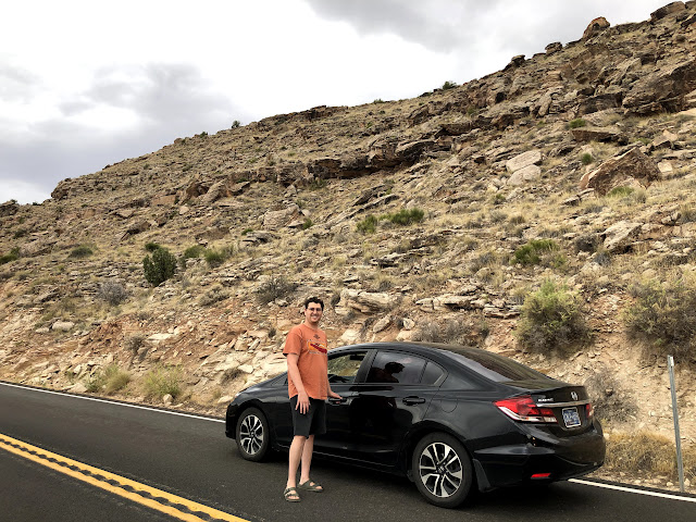
Of all the states we drove through, Utah was the most surprising. The landscape was downright other-worldy. It's known for its natural diversity and it didn't disappoint. We saw everything from arid deserts to thriving pine forests in mountain valleys. It was rugged and geographically diverse -- at the convergence of the Rocky Mountains, the Great Basin, and the Colorado Plateau. My iPhone photos definitely don't do it justice, but I don't know that any camera can. I think it's a you-need-to-see-it-to-believe-it scenario.
 |
| Western edge of Colorado |
 |
| Utah State Line |
We got off the interstate once hitting Utah and then the drive got real interesting. We took the Scenic Byway 128 along the Colorado River to Arches National Park. We began to wonder if the photo ops would ever run out? We were also prepared for a super hot day, but it turned out to be cool and overcast with pockets of rain which was welcome relief!
 |
| Grand County, Utah on 128 to Cisco |
 |
| Utah State Route 128 |
Utah State Route 128 is just over 70km long and is designated the Upper Colorado River Scenic Byway. This road also forms part of the Dinosaur Diamond Prehistoric Highway and a National Scenic Byway. The highway was originally built to connect rural eastern Utah to Grand Junction, Colorado (the largest city in the region).
 |
| Along the Colorado River just east of Dewey |
 |
| Along the Colorado River just east of Dewey |
|
The highway crosses the Colorado River at the site of the Dewey Bridge, listed on the National Register of Historic Places.  |
| Dewey Bridge Campground |
 |
| Dewey Bridge Campground |
 |
| West of Dewey |
 |
| Looking toward Dome Plateau and Colorado River |
State Route 128 runs into Arches National Park and then skirts around the south-eastern edge before ending just outside of Moab. Turn right and you head toward the park gates. We entered Arches with our America the Beautiful Pass.
 |
| Courthouse Towers, Arches National Park |
 |
| The Three Gossips, Arches National Park |
|
 |
| Balanced Rock, Arches National Park |
|
 |
| The Windows, Arches National Park |
|
 |
| Parade of Elephants, Arches National Park |
|
 |
| Garden of Eden, Arches National Park |
|
After Arches, we took a drive through Moab and then a quick jaunt on I-70 before getting off the interstate once again in favour of State Route 24, to begin another scenic byway -- this time Capitol Reef Scenic Byway. Here we drove along the eastern side of the San Rafael Reef, Goblin Valley State Park and then through Capitol Reef National Park.
The Mars Society established the Mars Desert Research Station just outside Hanksville, due to its Mars-like terrain!
 |
| Section of San Rafael Reef along route 24 near the Mars Society |
 |
A San Rafael Reef Swell
|
The San Rafael Reef is a geologic feature part of the Colorado Plateau. It is mostly composed of steeply titled layers of Sandstone, eroded into tall fins, domes, cliffs, and deep canyons.
The drive through Capitol Reef National Park itself was rugged and spectacular, showing off more sandstone cliffs and dome formations that run along the Fremont River to Pleasant Creek on Waterpocket Fold. A reef refers to any rocky barrier to land travel, just as ocean reefs are barriers to sea travel.
 |
| Capitol Reef National Park near Fruita |
Fruita, Utah (not to be confused with Fruita, Colorado) is the best-known settlement in Capitol Reef National Park. It is located at the confluence of Fremont River and Sulphur Creek. Despite its status as a ghost town, it is the location of the National Parks Service's employee residences. It was established in the late 19th century by a group of Mormons, but was abandoned in 1966 when the National Park Service purchased the town to be included in Capitol Reef National Park. As we drove through, we could see the restored schoolhouse as well as a few other historical buildings. The orchards also remain and apparently consist of about 2,500 trees. The orchards are preserved by the NPS as a "historic landscape".
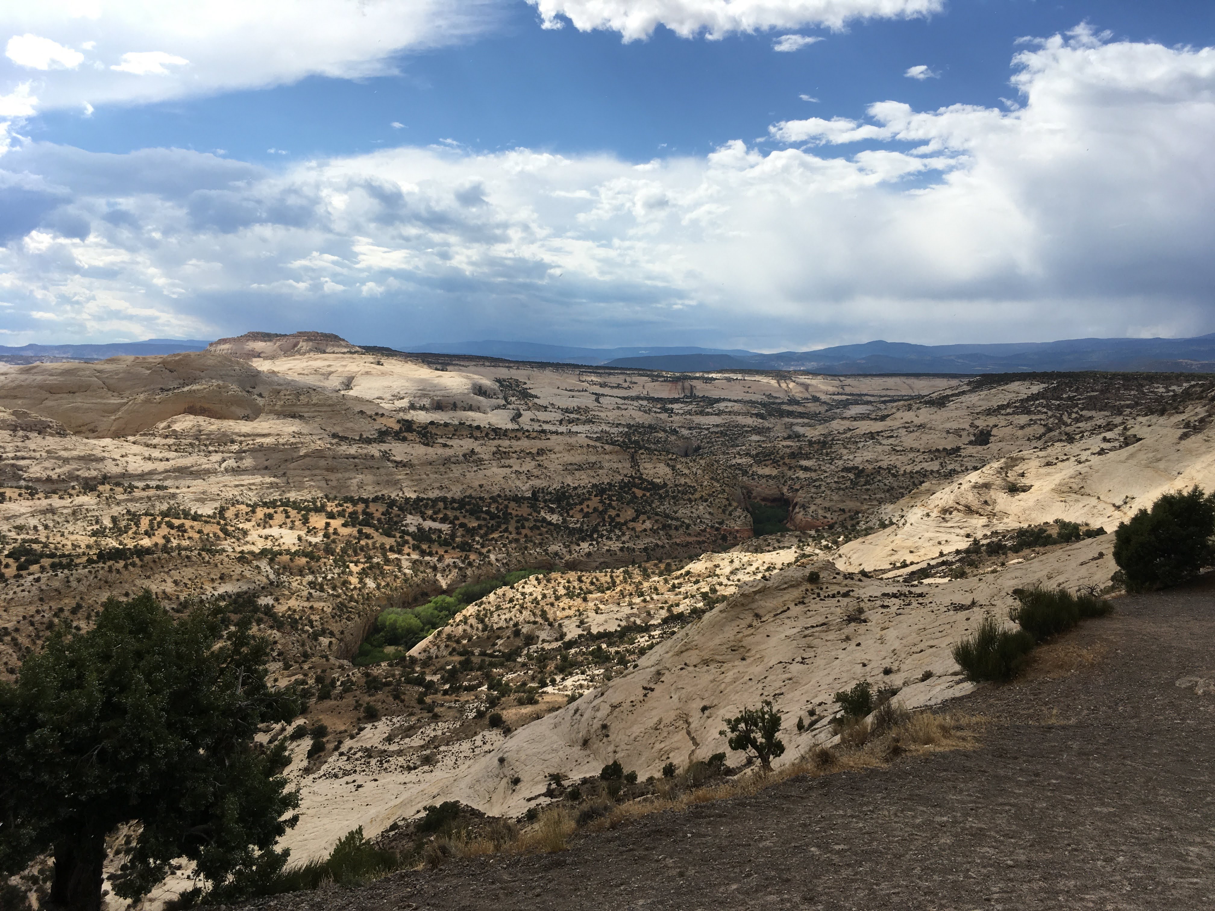
At Torrey, we turned left onto the All-American Road: Scenic Byway 12 (or Utah State Route 12). This is 200 km of pure driving delight. Although we were on route to Bryce, the destination was far from our minds as we left the desert and climbed through the clouds in Dixie National Forest. A stop at the scenic overlook near the road's summit on Boulder Mountain at about 9,000 feet put it all into perspective. The panorama includes the Henry Mountains, Grand Staircase-Escalante and the shimmering red rock of Capitol Reef National Park. And yet, there we were standing in 9 degree weather, amongst subalpine fir and aspen groves.
 |
| Route 12 Summit |
 |
| Route 12 Summit of Boulder Mountain |
|
 |
| Route 12 Summit of Boulder Mountain |
|
 |
| Route 12 |
 |
| Route 12 |
 |
| Route 12 |
The entire route is "open range" where cattle roam freely between grazing lands. We saw plenty of small groups of cattle out on their own, and one group being moved by ranchers (and their working Aussie).
 |
| Beginning of Hogback Ridge |
Along the Hogback Ridge between Boulder and Escalante, the road narrows and hairpin turns dare you on a road that drops off drastically from the shoulders down into deep canyons below. Those were the most thrilling miles! There are no guard-rails and one hairpin turn follows another, with 14% grades at times.
 |
| Hogback Ridge |
 |
| Hogback Ridge |
 |
| Hogback Ridge |
 |
| Hogback Ridge |
 |
| Hogback Ridge |
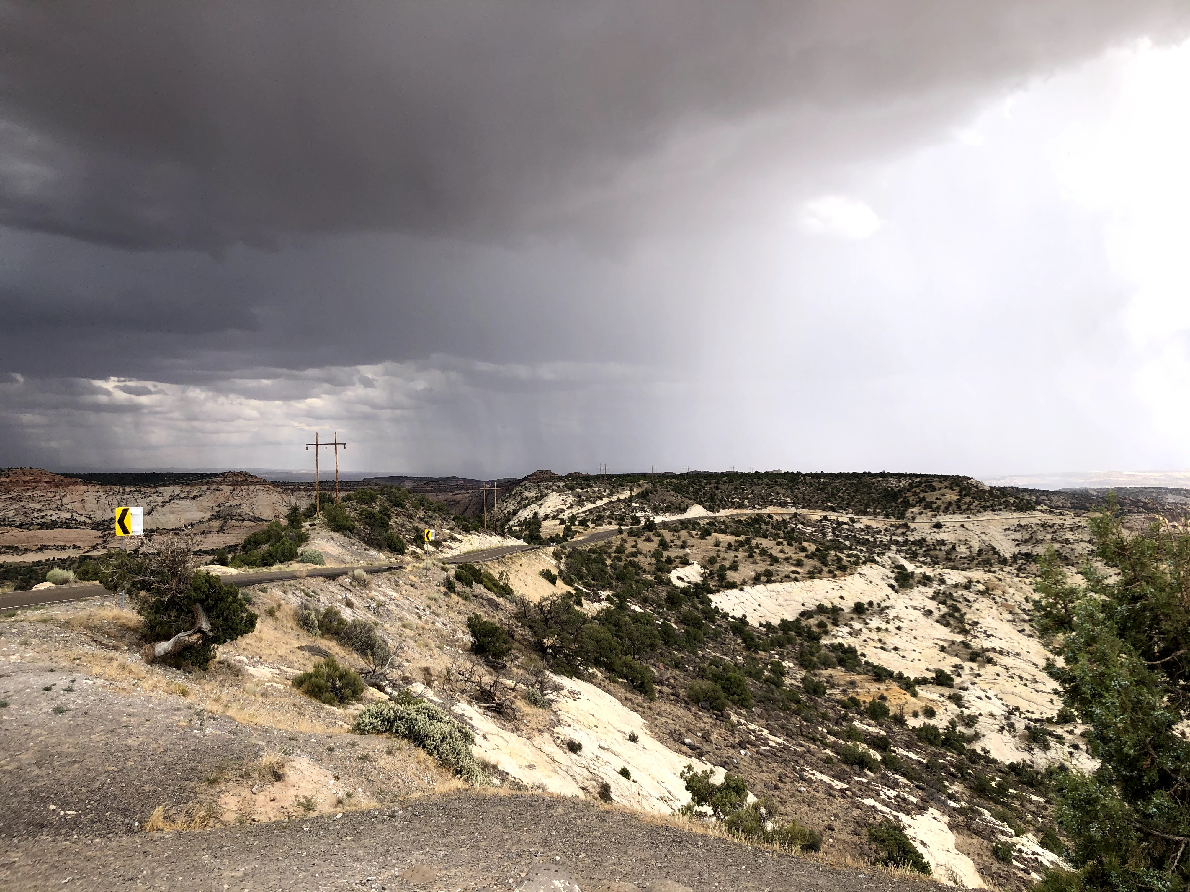
At the end of the ridge is Escalante, nestled between Capitol Reef and Bryce Canyon national parks and perched on the edge of Grand Staircase National Monument (unspoiled cliffs, canyons, and plateaus). We continued to drive through clouds, rain, wind, and sun... the temperatures ranging from 9 degrees to high 20s, sometimes in a matter of minutes. We learned that southern Utah and this area of the Colorado Plateau is prone to monsoons in summer, when thunderstorms and heavy rains (and flash floods) are probable.
The unpredictable weather paid off though -- just southwest of Escalante on Route 12 we simultaneously looked in our rear-view mirrors and noticed the ultimate double rainbow!  |
| Kaiparowits Plateau Straight Cliffs and Rainbow in Grand Staircase-Escalante National Monument |
To the south and southwest of Escalante is the Kaiparowits Plateau. To the west are the Dixie National Forest (2 million acres worth!) and the Escalante Mountains.
 |
| Grand Staircase-Escalante National Monument |
 |
Route 12 outside of Henrieville
|
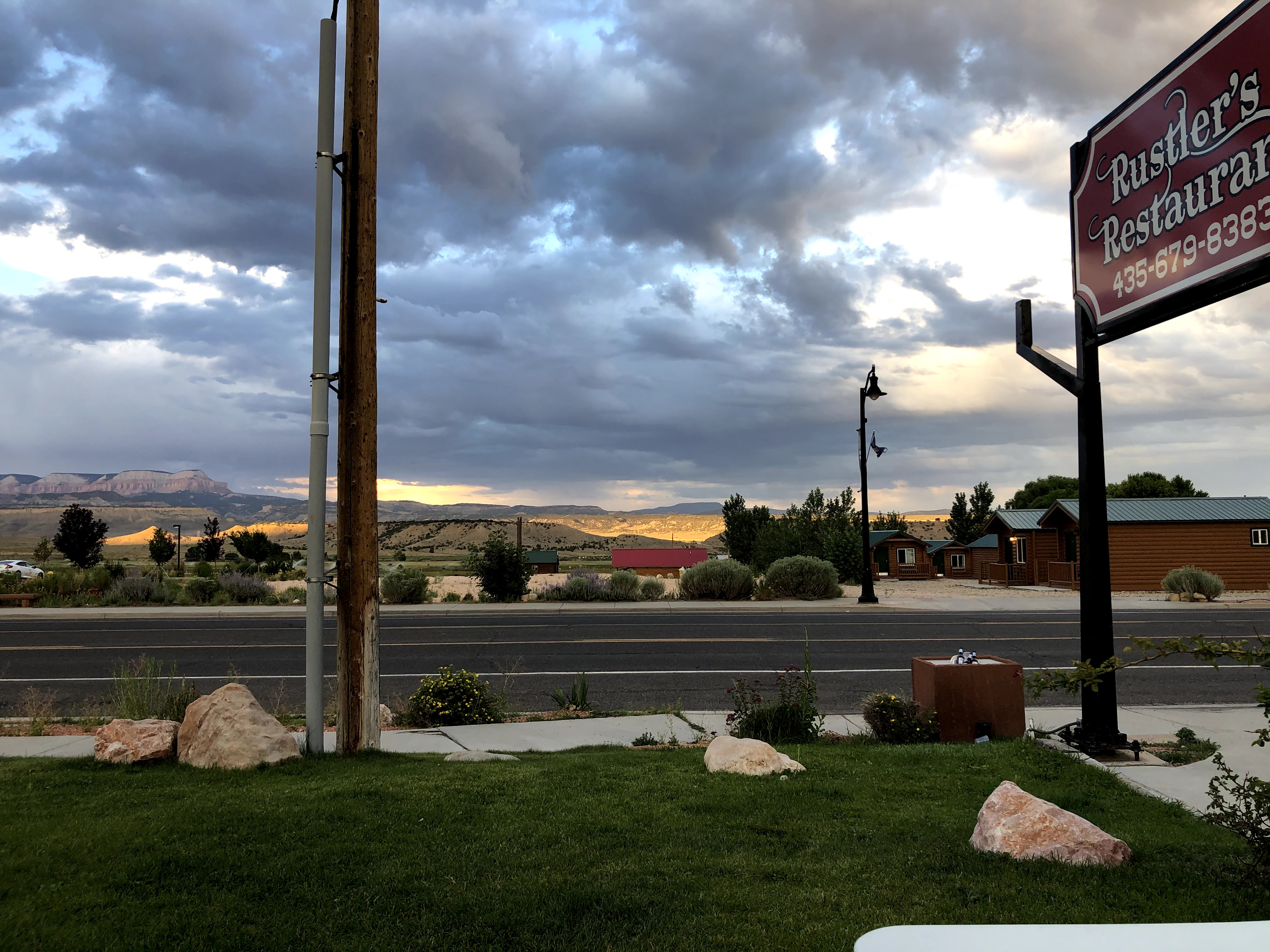
We got settled in Bryce Canyon City for the evening and headed out for dinner.
 |
| Checking in to our hotel in Bryce Canyon City |
 |
| Dinner View in Tropic |
 |
| Our fourth and final rainbow of the day |
 |
Tropic looking toward Powell Point & Table Cliff Plateau
|
Day 6: ~ 500 km
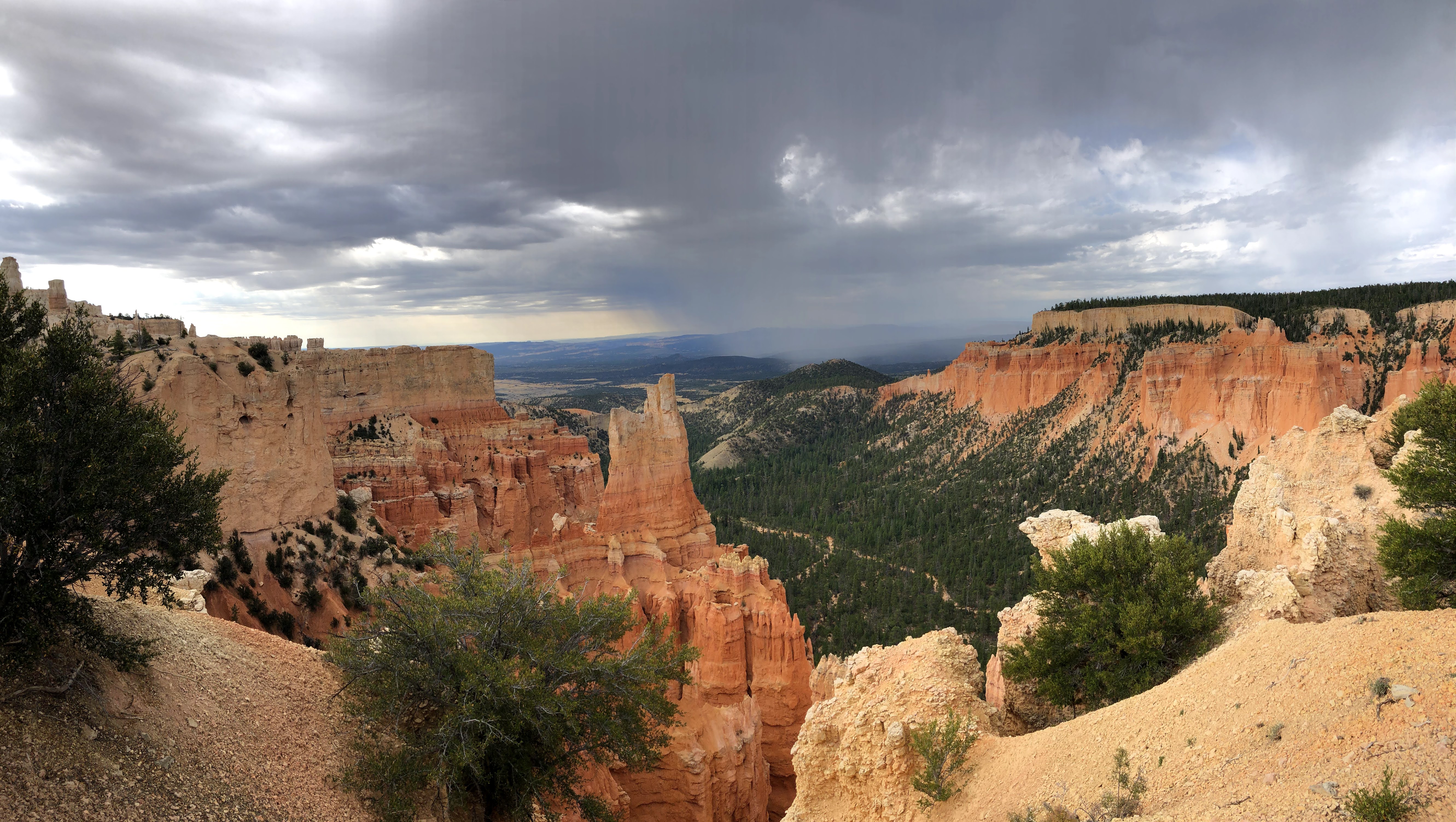
In the morning we entered Bryce Canyon National Park. We spent most of our time on the Rim Trail between Sunset and Sunrise Point, as well as the Bryce Canyon Lodge and Paria View. We also saw a herd of deer.
 |
| Deer |
 |
| Sunset Point |
 |
| Sunset Point |
 |
| Sunset Point |
 |
| Sunset Point |
 |
| Sunset Point |
 |
| Rim Trail |
 |
| Rim Trail |
 |
| Rim Trail toward Sunrise Point |
 |
| Paria View |
 |
| Paria View |
 |
| Paria View |
After Bryce, we carried on along the southeastern edge of Dixie National Forest to Zion National Park.
 |
| Driving into Zion National Park |
 |
| Zion National Park Mesa |
 |
Zion-Mount Carmel Tunnel, Zion National Park
 | | Zion National Park |
|
As we drove through Zion National Park, we were surrounded by massive sandstone cliffs of cream, pink, and red in a narrow canyon.
 |
| East Temple, Zion National Park |
 |
| Zion National Park |
 |
| Zion-Mount Carmel Highway, Hairpin turns |
 |
| Zion National Park |
 |
| Zion National Park |
 |
| Zion-Mount Carmel Highway, bottom of hairpins |
 |
| Bridge Mountain, Zion National Park |
 |
| Zion-Mount Carmel Highway |
 |
| Zion National Park |
 |
| Zion National Park |
 |
| Springdale Town Park looking toward West Temple, Zion National Park |
We had a late lunch in St. George, Utah and things really started to heat up (back to the mid 40s).
 |
Lunch in St. George
The ensuing drive through the northeastern most part of the Mojave Desert to Las Vegas was both scenic and desolate... oh, and VERY hot. After a cold shower and some recuperation in the hotel room A/C we went for a delicious fajita dinner and a cruise through The Strip.
Day 7: ~ 450 km
|


WOW!!! Spectacular account of that section of your travels! And even though, as you say, photos seldom do justice to epic vistas, they come across convincingly with your captures and words!
ReplyDeleteStunningly beautiful photos from a fantastic pair of travel days! Its too bad The Hot Tomato Pizza in Fruita, and the Kiva KoffeeHouse in Escalante were closed as you travelled through, I would really have enjoyed reading your reviews :)
ReplyDeleteYes, that is too bad. Well... there is always the drive back.
DeleteIncredible!!!
ReplyDeleteI can't even imagine how beautiful it must have been in person, as those pictures are breath taking. Couldn't pick a favourite if I tried!
From landscapes to city - what a fun drive through the strip